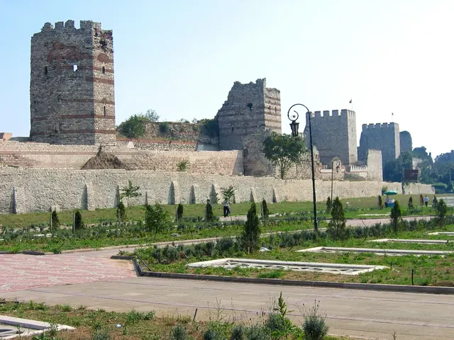
The Theodosian Walls are the 5th-century land walls of Constantinople, a triple barrier of inner wall, outer wall and moat running from the Sea of Marmara to the Golden Horn. They held off invaders for a thousand years until Mehmed II's army broke through in 1453, and today, as part of a UNESCO World Heritage Site, most of their length can still be followed on foot.
On this page6
Rebuilt in under two months
By the early 400s the city had outgrown Constantine's boundary, so Anthemius, regent for the young Theodosius II, built a new and far stronger wall further west between 408 and 413. In 447 a major earthquake brought down long sections just as Attila's Huns were rampaging through the Balkans. The prefect Constantine mobilised the citizens, including the Blue and Green chariot-racing factions, repaired the walls in about two months, and added a second outer wall and a moat for good measure.
An inscription in Greek and Latin at the Mevlanakapı gate celebrates the feat, boasting, as sources relate, that even the goddess Pallas could hardly have built so strong a fortress so quickly.
How the triple defence worked
An attacker first faced a moat about twenty metres wide, then a low breastwork, then the outer wall, and finally the massive inner wall, around twelve metres high. Both walls bristled with towers, and because the towers of the inner wall were staggered with those of the outer, defenders could shoot from two levels at once.
The system saw off Avars and Persians in 626, two great Arab sieges in the 7th and 8th centuries, and assaults by Bulgars and Rus. Even the Crusaders of 1204 got in not over the land walls but through the sea walls along the Golden Horn.
1453: the final siege
When Mehmed II opened the siege on 6 April 1453, he pitched his tent opposite the Gate of St Romanos, today's Topkapı. Giant bombards cast by the Hungarian founder Urban pounded the walls for weeks, especially in the Lycus valley, where the ground dips and the defences were weakest. In the final assault on 29 May the Genoese commander Giustiniani was wounded and withdrew, the last emperor Constantine XI died fighting, and the Ottoman army entered the city.
Turkish tradition holds that the soldier Ulubatlı Hasan planted the Ottoman banner near Topkapı and that the sultan himself rode in through Edirnekapı. The Panorama 1453 History Museum recreates that morning in vivid detail.
Walking the walls, section by section
- Yedikule to Belgradkapı: the Yedikule Fortress at the southern end, with historic market gardens farmed in the moat since Byzantine times.
- Mevlanakapı: the gate with the 447 inscription; look carefully, it is easy to miss.
- Topkapı: the heart of the 1453 siege, with the Panorama museum and a park just inside.
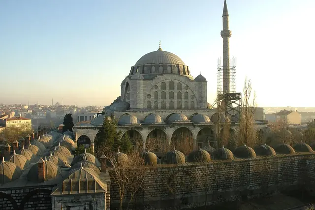
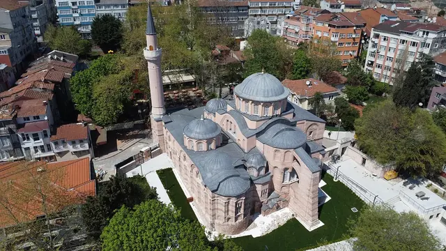
- Edirnekapı: the highest point of the old city, a few minutes from the Mihrimah Sultan Mosque and the Chora Church.
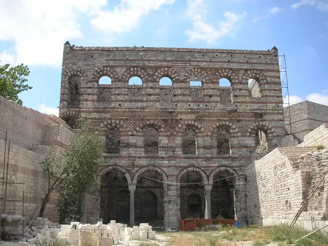
- Tekfur Palace to Ayvansaray: the Theodosian line ends near the Tekfur Palace, where later Blachernae walls descend to the Golden Horn.
Walking safely and well
Walking the full length takes several hours, so most visitors pick one or two stretches. Some sections have been heavily rebuilt in recent decades, work that remains controversial among specialists; look at unrestored stretches too if you want to see the original banded stone and brick.
Parts of the route are isolated. Walk in daylight, preferably not alone, and never climb crumbling towers or unguarded parapets, especially with children. Our safe travel guide has more general advice.
Getting there from Sareban Hotel
It depends where you start. For Topkapı, simply take the T1 tram from the Sultanahmet or Çemberlitaş stop near the hotel to the Topkapı stop; the tram passes right through the walls. For Edirnekapı, use a taxi or a bus from Eminönü; for the southern end, the rail line along the Marmara shore towards Yedikule or a taxi along the coast road works well.
To start in the north, take the Golden Horn ferry from Eminönü to Ayvansaray and follow the walls south. Our Byzantine Istanbul route ties the walls together with the city's other Byzantine sites.
Frequently asked questions
How long are the Theodosian Walls?
The land walls run about 6.5 kilometres from Yedikule on the Marmara to Ayvansaray on the Golden Horn; the northernmost section belongs to the later Blachernae walls.
Can you walk on top of the walls?
In a few restored sections and inside Yedikule Fortress, yes. Climbing crumbling or unguarded stretches is dangerous and not recommended.
Is it safe to walk along the walls?
Generally yes in daylight on busier stretches. Avoid isolated sections alone and do not stay after dark.