The Marmara Sea Walls are the Byzantine fortifications that protected Constantinople from attack by sea, running along the shore from Sarayburnu to Yedikule. Broken in places but still impressive, they can be followed along Kennedy Avenue today. The stretches around the Bukoleon Palace, Ahırkapı and Kumkapı are the easiest to reach and the most photogenic.
On this page5
The defence line overshadowed by the land walls
Mention Istanbul's walls and most people picture the mighty triple land walls, but the city was also ringed with stone along the Marmara and the Golden Horn. The Marmara stretch runs for roughly 8 kilometres. Its first phase goes back to Constantine; as the city grew westwards, the line was extended under Theodosius II in the first half of the 5th century to meet the new Theodosian Land Walls.
The sea walls were never as thick or layered as the land walls: the Marmara's currents and shallow, rocky shoreline already made a large-scale landing difficult, so a single wall with regularly spaced towers usually sufficed. In the 9th century Emperor Theophilos carried out a major rebuilding, and inscriptions bearing his name still survive at several points along the line.
Reading the walls: inscriptions, spolia and gates
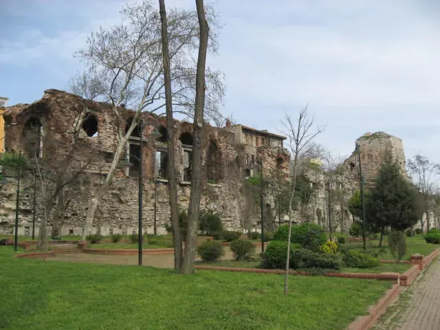
Stand in front of the walls and look closely — it is like reading a history book. Bands of brick alternate with courses of stone, and old marble column shafts laid horizontally as tie-beams poke out of the masonry: recycled material, or spolia, from earlier buildings. On some towers you can pick out Greek inscriptions and carved crosses.
Many of the neighbourhood names along this shore come from the walls too: Ahırkapı, Çatladıkapı, Kumkapı and Yenikapı are the Ottoman names of old sea gates, which once opened onto harbours, palace gardens or fishermen's landings.
Railway and coastal road: the walls' recent history
Earthquakes, fires and repairs reshaped the walls over the centuries, but the biggest changes came in the modern era. In the late 19th century the railway heading west from Sirkeci was laid along the inside of the walls, and some sections were demolished in the process. Then in the 1950s land reclamation for Kennedy Avenue separated the walls from the sea altogether.
The result is a patchwork: in places the wall rises almost to its original height, elsewhere it has become the back wall of houses, and in some spots only foundations remain. Restoration and landscaping work has been carried out on several sections in recent years.
Where to see the walls at their best
- The Bukoleon façade: with its marble windows set into the walls, the Bukoleon Palace is the showpiece of the whole line.
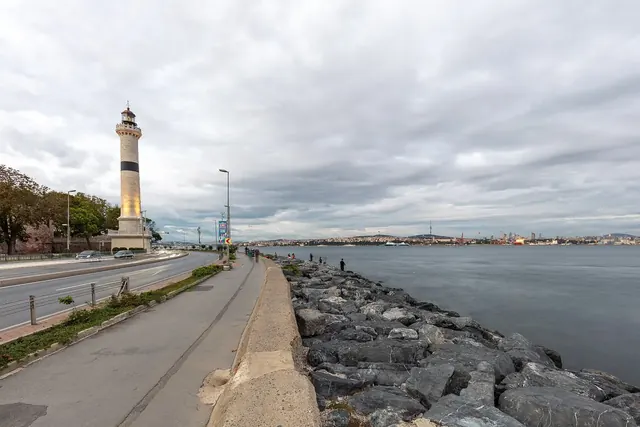
- Around Ahırkapı: the towers supporting the Ahırkapı Lighthouse and the long stretches on either side.
- Çatladıkapı: just west of the Bukoleon, the remains of a sea gate said to be named after a crack caused by an earthquake.
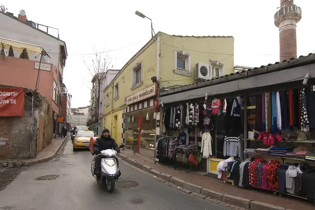
- Towards Kumkapı: walking west along the shore past Kumkapı, you see the wall woven into houses and gardens.
- The far end: in the west the sea walls meet the land walls at Yedikule Fortress.
Getting there from Sareban Hotel
The walls are the shoreline just below our hotel: walk downhill through the lanes of Küçük Ayasofya, cross the railway line and they are right in front of you. Follow the Kennedy Avenue promenade east towards the Bukoleon and Ahırkapı or west towards Kumkapı for as long as you like. To trace Byzantium across a whole day, try our Byzantine Istanbul route.
Frequently asked questions
Do you have to pay to see the sea walls?
No. The walls are in the open and can be seen for free from the promenade, the seaside park and the neighbourhood lanes.
What is the difference between the sea walls and the land walls?
The land walls on the city's western side are a powerful triple defence line. The sea walls along the Marmara and the Golden Horn are thinner, usually a single wall with towers, because attacking from the sea was harder in the first place.
Where are the walls best preserved?
The Bukoleon Palace façade and the area around the Ahırkapı Lighthouse are both the best-preserved and the easiest to reach.
How far can I walk along the walls?
The promenade runs from Sarayburnu to Yenikapı and beyond. Bukoleon to Ahırkapı is a short stroll; for a longer route, continue west towards Kumkapı.