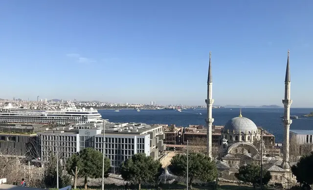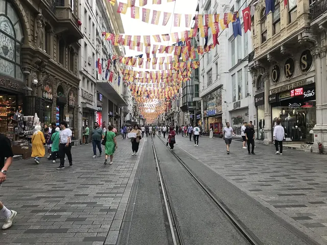
İstiklal Avenue is the pedestrian street, about 1.4 kilometres long, that runs from Tünel Square to Taksim Square and forms the backbone of Beyoğlu. Known in Ottoman times as the Grande Rue de Péra, it is lined with 19th-century apartment blocks, historic arcades, churches and former embassies. A red heritage tram still trundles along its length, keeping alive the memory of Istanbul's cosmopolitan past.
On this page6
From the Grande Rue de Péra to İstiklal
In Byzantine and Genoese times Pera was a hillside of vineyards and gardens. From the 16th century European states began building their embassies here, and by the 19th century the Grande Rue was the most modern street in the Ottoman capital, lined with Greek, Armenian, Jewish and Levantine shops, patisseries, theatres and hotels. After a great fire swept through Beyoğlu in 1870, the wooden houses were replaced by the masonry apartment buildings and arcades you see today.
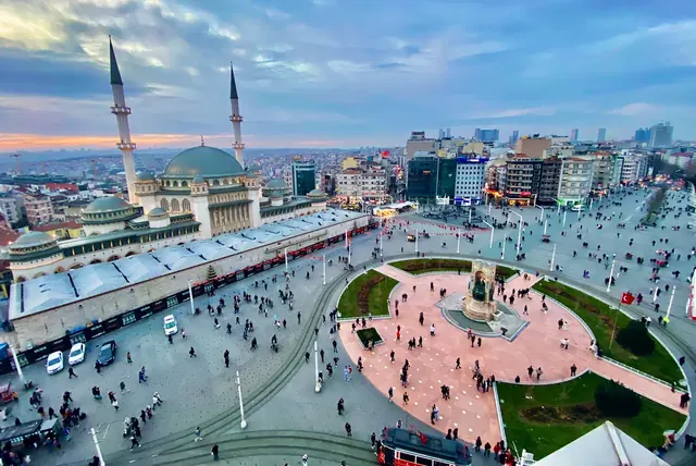
After the founding of the Republic, the street was renamed İstiklal, meaning independence, in honour of the victory in the War of Independence. Throughout the 20th century its cinemas, bookshops and cafés made it the centre of Istanbul's cultural life, and it is still the city's liveliest pedestrian artery. Taksim Square lies at its northern end, and the upper station of the Tünel funicular at its southern end.
The story of the red tram
Horse-drawn trams first ran along the street in the second half of the 19th century and were replaced by electric trams in the 1910s. Trams disappeared from the European side in the early 1960s, and for decades İstiklal carried cars. When the street was pedestrianised in 1990, vintage-style red and white cars returned to the rails.
Today the heritage tram shuttles between Tünel Square and Taksim, passing through Galatasaray. The ride is short but charming, and children love watching the crowds through the windows of the old-fashioned car. Services can be infrequent and are sometimes suspended for maintenance or events, so don't worry if you miss it; the avenue is made for walking anyway.
What to look out for along the way
- St Anthony of Padua Church: Istanbul's largest Catholic church, with a red-brick neo-Gothic façade by the Italian architect Giulio Mongeri, built in the early 20th century. Visitors may enter quietly and modestly dressed.
- Former embassies: Palatial buildings from the days when Istanbul was the capital, now used as consulates. Look for their façades behind high garden walls.
- Galatasaray High School: A school whose roots go back to 1481, reorganised as a modern lycée in 1868. Its grand iron gate is the symbol of Galatasaray Square.
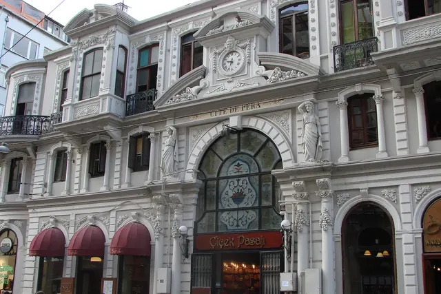
- Çiçek Pasajı: The glass-roofed arcade of the Cité de Péra building, dating from 1876.
- Hüseyin Ağa Mosque: The only mosque on the avenue itself, founded in the late 16th century and rebuilt since; handy at prayer times.
- Botter Apartments: Designed by the Italian architect Raimondo D'Aronco for the palace tailor Jean Botter and considered one of Istanbul's first Art Nouveau façades.
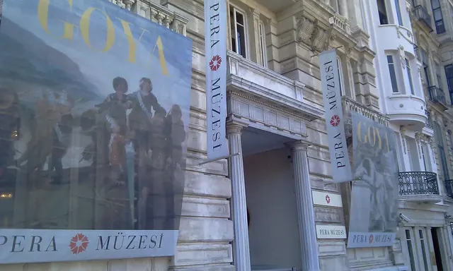
- Historic arcades: The Atlas, Hazzopulo and Avrupa (Mirrored) passages show the avenue's hidden side and the commercial life of the 19th century. Side streets towards Meşrutiyet Street lead to the Pera Museum.
Family-friendly bites
İstiklal and its side streets are full of simple treats for families. In winter, carts sell roasted chestnuts and grilled corn; in summer, ice-cream sellers serve stretchy Maraş dondurma with a playful routine that children adore. Traditional patisseries offer profiteroles, kazandibi and rice pudding, börek shops serve su böreği, and canteen-style restaurants in the side streets dish up home-style stews and köfte, all easy, alcohol-free lunch options. Our street food guide has more ideas.
In the evening some side streets fill with nightlife venues, so daytime and early evening are the best times for a family stroll.
Crowds and safety
İstiklal is very crowded, especially on weekend afternoons. Keep wallets and phones in a front pocket or a closed bag, hold children's hands, and agree on an easy-to-find meeting point, such as the gate of Galatasaray High School, in case you get separated. Security measures are sometimes in place around Taksim. See our safe travel tips for general advice.
Getting there from Sareban Hotel
There are two easy options. Either take the T1 tram from the Sultanahmet or Çemberlitaş stop near our hotel to Karaköy, ride the Tünel funicular up to Tünel Square and walk towards Taksim; or take the T1 to the end of the line at Kabataş, ride the F1 Kabataş–Taksim funicular up to Taksim and stroll the avenue towards Tünel, gently downhill.
With the second option you can finish by walking down Galip Dede Street to Galata Tower and catching the tram back from Karaköy. For the wider district, see our Beyoğlu and Taksim guide.
Frequently asked questions
How long is İstiklal Avenue and how long does it take to walk?
It's about 1.4 km. You could walk it in half an hour without stopping, but allow two to three hours to explore the buildings, arcades and churches.
How do I ride the heritage tram?
Board at the Tünel or Taksim end using an Istanbulkart. Services are infrequent and are occasionally suspended.
Is İstiklal Avenue suitable for children?
During the day, yes. It's closed to traffic, and treats like ice cream and roasted chestnuts keep kids happy. Watch out for the crowds.
Is there a mosque on İstiklal Avenue?
Yes. Hüseyin Ağa Mosque stands on the avenue between Galatasaray and Taksim, and Taksim Mosque is at the Taksim end.